
When a catastrophic highway collision occurs, a massive industrial structure collapses, a fatal workplace accident happens, or a complex property line dispute escalates into a multi-million-dollar lawsuit, the physical scene holds the definitive key to determining liability, fault, and cause. However, physical evidence is notoriously transient: skid marks fade under rain and traffic, wreckage is cleared to reopen vital roadways, structural debris is removed for safety, and human memory degrades rapidly. Forensic surveying—also known as forensic metrology or legal surveying—is the specialized discipline that applies high-precision measurement, 3D documentation, and spatial analysis techniques to investigate accidents, crimes, structural failures, and legal disputes, transforming chaotic physical wreckage into objective, court-admissible engineering evidence.
The Intersection of Metrology and the Law
Unlike routine engineering surveys that focus on building new infrastructure or cadastral surveys that establish future property lines, forensic surveying is inherently retrospective. It looks backward in time to reconstruct past events with rigorous scientific precision.
A forensic surveyor operates at the intersection of surveying science, physics, and jurisprudence. Their work is governed by stringent legal standards—such as the Daubert standard in United States federal courts—which dictate that scientific evidence and expert testimony must be grounded on reliable methodologies, peer-reviewed techniques, and reproducible measurements. A forensic surveyor must not only capture data with millimeter-level accuracy but also maintain an unbroken, legally defensible chain of custody for all digital evidence, ensuring that point clouds, field notes, and scaled diagrams withstand aggressive cross-examination by opposing legal counsel in a court of law.
Core Applications and Investigation Scenarios
Forensic surveying is deployed across a diverse spectrum of legal and investigative contexts:
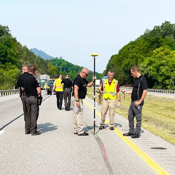
- Motor Vehicle Collision Reconstruction: Serious multi-vehicle highway crashes involve complex physics: vehicle speeds, braking distances, impact angles, throw distances of pedestrians, and friction coefficients of pavement. Forensic surveyors capture the entire collision scene—including pavement gouge marks, tire yaw marks, fluid spill pools, resting positions of vehicles, and sightline obstructions along the roadway—creating a precise 3D digital model that accident reconstructionists use to calculate pre-impact velocities and vehicle trajectories.
- Structural Collapses and Construction Failures: When scaffolding collapses, a crane topples over, a retaining wall fails, or a building roof caves in under snow loads, forensic surveyors map the collapsed debris field in three dimensions. By analyzing fracture angles, structural deformation, and spatial displacement vectors, structural engineers determine whether failure resulted from material defects, design calculation errors, or substandard contractor execution.
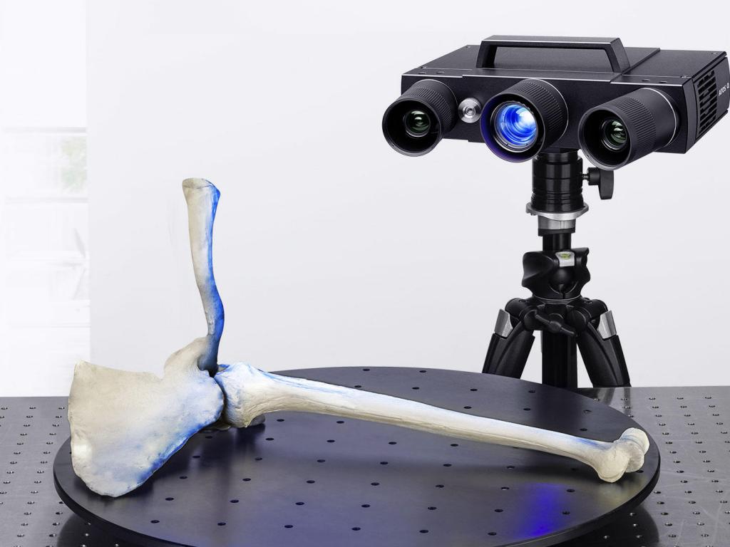
- Crime Scene Documentation and Ballistics: In complex criminal investigations, preserving the exact spatial relationships of physical evidence—such as spent bullet casings, blood spatter patterns, victim locations, and weapon positions—is critical. Using high-resolution terrestrial laser scanners and photogrammetric cameras, forensic surveyors map indoor crime scenes and outdoor landscapes in complete 3D detail, enabling trajectory analysis and bullet flight path reconstruction long after the scene has been cleaned.
- Slip-and-Fall and Premises Liability: Slip-and-fall accidents often hinge on micro-topography: the exact slope of a wheelchair ramp, the depth and slip resistance of a stair tread, the height variation of a sidewalk joint, or the inadequate drainage pitch of a commercial entryway floor. Forensic surveyors measure these surfaces to sub-millimeter tolerances, verifying whether they comply with local building codes, ADA accessibility standards, and industry safety regulations.
Advanced Instrumentation: Capturing Transient Evidence Instantly
Time is the forensic surveyor’s greatest enemy. Weather events, emergency rescue operations, and traffic flow requirements demand rapid data capture before physical evidence is permanently altered or destroyed. To meet this challenge, forensic surveyors deploy advanced remote sensing technologies:
- Terrestrial Laser Scanning (TLS): Tripod-mounted laser scanners are deployed immediately upon arriving at a scene. Sweeping 360 degrees, they capture millions of 3D points per second, recording every piece of wreckage, guardrail deformation, and roadway contour in photorealistic geometric detail. This creates an immutable digital twin of the scene.
- Unmanned Aerial Vehicles (UAVs): For large-scale collision scenes spanning multiple highway lanes, expansive industrial plant explosions, or remote outdoor search areas, drone photogrammetry and aerial LiDAR capture high-resolution orthomosaics and 3D surface models from above safely without disrupting emergency response operations.
- Total Stations and GNSS Rovers: Used to tie forensic scan data into national geodetic control frameworks, measure specific vehicle suspension heights, and verify critical spot elevations with absolute precision.
Analytical Workflows and Courtroom Deliverables
Capturing raw field data is only the first phase of a forensic survey; transforming that data into clear, persuasive, and legally defensible courtroom exhibits requires sophisticated processing:
- Point Cloud Registration and Fusion: Surveyors align multiple laser scans and drone datasets into a single unified coordinate system using advanced software, eliminating shadows and occlusions caused by wrecked vehicles or emergency response equipment.
- Trajectory and Sightline Analysis: Using CAD and physics simulation software, investigators project bullet trajectories backward through 3D space to determine shooter positions, or model driver sightlines to determine whether foliage, parked cars, or roadway crests obstructed a driver’s view prior to a pedestrian strike.
- Courtroom Exhibits and 3D Animations: The final deliverables often include scaled 2D engineering plans, color-coded elevation mismatch maps, orthomosaic aerial exhibits, and photorealistic 3D virtual reality walkthroughs or animations that allow judges and juries to visualize the exact sequence of events clearly.
By replacing subjective eyewitness testimony and ambiguous hand-drawn sketches with uncompromised mathematical measurements and objective 3D spatial models, forensic surveying ensures that truth and justice are anchored in indisputable physical reality.